Measuring Areas on Maps
1. Irregular shapes are common in map work. They include features like lakes, forests, swamps, islands, plantations among others.
2. The most appropriate way is by using the grid square method.
3. The distance between 2 grid lines on a map with a scale of 1:50,000 is 2cm which is equal to 1km on the ground.

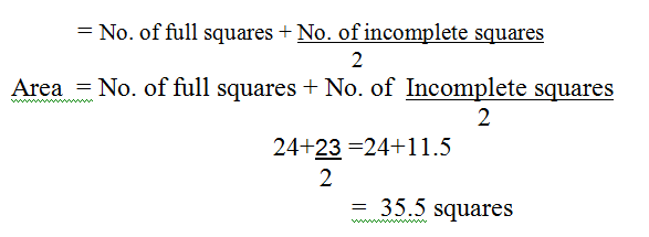
4. To find the area of an irregular shape on topographical maps requires to take the following steps:
- Count the number of full squares.
- Count the number of incomplete (also known as half) squares and divide by two.
![]() Area of an irregular feature
Area of an irregular feature

But the area of 1 grid square = 1km2
Since 1 square length is 1km
A = 35.5 x 1 = 35.5 km2.