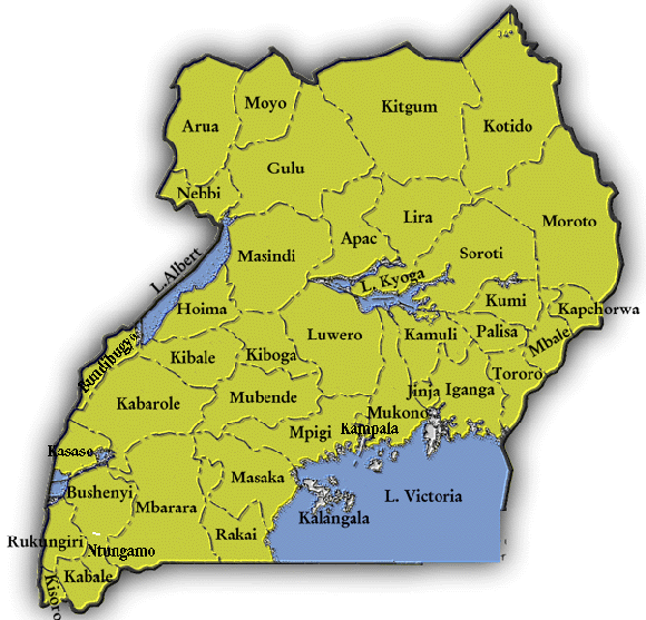
TOPIC 1: LOCATION OF UGANDA ON THE MAP OF EAST AFRICA
Uganda is a landlocked country in East Africa. It is bordered to the east by Kenya, to the north by South Sudan, to the west by the Democratic Republic of the Congo, to the south-west by Rwanda, and to the south by Tanzania.
The southern part of the country includes a substantial portion of Lake Victoria, shared with Kenya and Tanzania.
Uganda is divided into 112 districts as of July 2011, with one Capital City of Kampala, and across four major administrative regions.
Most districts are named according to their main towns or administrative centres.
Each district is also divided into either counties or municipalities. The political head of a district is elected and his/ her title is chairperson Local Council Five.

Activity
Study the map of Uganda above and answer the following questions.
1. List the neighbouring districts to your home district.
2. List the neighbouring districts of Kampala city.
3. What is the direction of Kampala from your home district?
4. Name the district where your village is found.
5. In which district is the capital of Uganda located?